Permaculture Learning Activities 1 – Exmouth seafront
Part of the the online permaculture design course I am taking are the activities to embed learning. We have been asked to choose a piece of land, probably not the one that we will use for our final design, to explore and develop the skills that we need. I have finally chosen my piece of land – a strip of sand on the seafront opposite a new development of cafes, shops and a watersports centre. I pass it two or three times a week depending on the route I take for my morning walk so can track it regularly throughout the seasons. It isn’t a place of peace and quiet but it is a place that looks a bit sad and unloved and I have often thought that it needs a design to improve it rather than just planting.
Observation and reading the land are key skills in permaculture design. They are what we use as the basis for our work and these activities are designed to start to develop those skills.
What follows are my answers to the questions about the place, firstly using Google Earth.
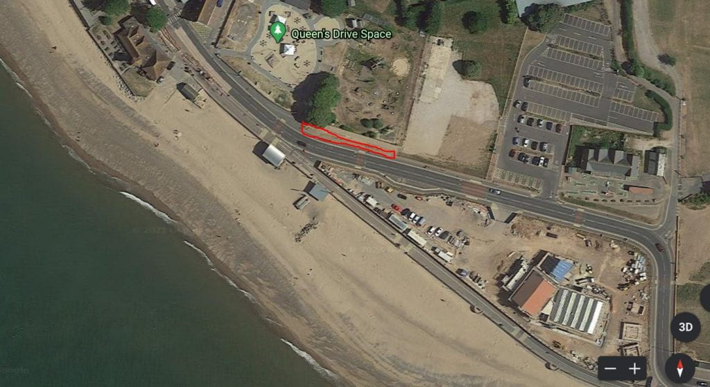
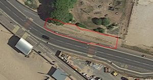
What about this place stands out or draws your attention?
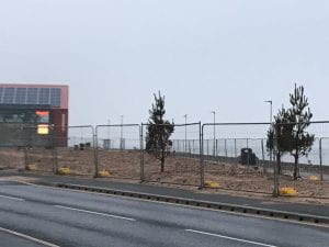
Mostly what stands out is the fact that it looks so uncared for. It is a scruffy bit of land sandwiched between two pavements, one lower down and one level with the road. It appears at the end of the fencing for a carpark. Parts of it are walked on frequently enough to stop anything growing and where plants do grow, they are not very tall. As they start to landscape the new water sports centre across the road, this forgotten scrap of land looks more and more unloved and yet has the potential to be quite exciting and a visual attraction for what is a key tourist spot for the town.
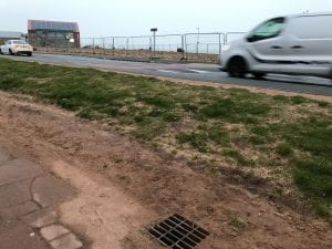
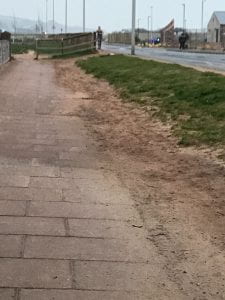 The land is quite steeply sloped down to the pavement and the pavement has a slight slope towards the land. What this means is that when it rains, a large puddle builds up because the one and only drain fills up with sand over time. I am also pretty sure that the drain leads straight through to the beach and the water is not spread throughout the patch of land ready to be used by the plants that are there.
What doesn’t stand out when you are there is the large tree that is so obvious in the Google Earth images. I need to go and look at it next time I walk.
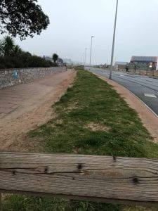
Are there plants and animals in this place that you recognise?
There are plants although at the beginning of March, not a lot (apart from a great big tree I missed when I was there!). One thing that has colonised the land where it is not walked on is grass which has probably stabilised the area due to the matting roots of the plant. Where there is a fence at the end of the land, presumably to stop people walking on it, there are a cluster of plants around the posts. Soil/sand will have built up around the posts and so plants have found their way there and I suspect the posts also offer a modicum of protection from the wind. One of the things that I intend to do over time is look closely at the plants growing there, on the nearby car park and those that are being planted in the new development.

What yields is this system generating already that most people walking by would never notice?
The yields are so invisible at the moment that I can’t see them! What I see in the land is a potential for yield but I am struggling with this one. At a stretch I could say:
- Because the pavements aren’t wide enough, it provides extra space for people to walk side by side.
- It is a water-collecting system even though that does get in the way of people.
- I am not sure if you can have such a thing as a negative yield but one I think we have here is that it is a barrier to where people want to walk and there is nothing to stop them trampling all over it.
How is the system acting in ways today that will help it survive and thrive tomorrow?
This is really about succession, the idea that all land really wants to move towards a stable ecology, that is often a forest, and that there are steps to get there.
First of all there are the annual weeds that cover the land which when they die back, provide organic matter for the soil. This then encourages plants with net-like roots to establish, grass, to stabilise the soil and prevent erosion. This is the stage that we are at and is one that the patch of land may never really move away from because it is trodden on and because of the wind from the south and south west which blow through particularly in the autumn and spring. Other plants are colonising around the posts of the fence where there is more protection and build up of growing matter and this may prove to be one way in which we can support plants to survive and move out. They are creating their own windbreak which then allows other plants to succeed.
Design by map overlays
Design requires mapping as a way to share what you know about the land and what might have an effect on what you want to do. Below are a series of maps that show information about my chosen site.
First we have windy.com which shows the way the wind is blowing in real time. The plot being right on the seafront, wind is a real issue for the site.
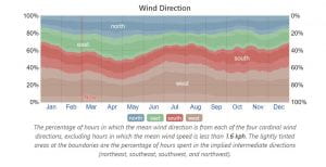
This small chart shows that the wind we get is not just south westerly but can be from all directions, although the south and west make up the majority and October to the start of March is when it is the windiest.
Using Verge’s Contour map generator is not totally helpful because although it shows the contours, the slope of the land is against the contours.
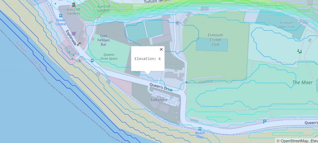
The best mapping for the site is to draw it by hand because it is too small to map using apps.